
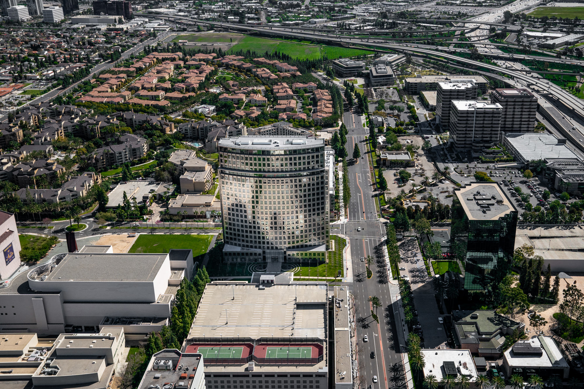
Aerial photography changes what is possible in real estate and architectural imaging. A $20 million oceanfront estate in Laguna Beach whose site context, ocean frontage, and relationship to the coastline cannot be communicated from ground level. A 500,000 square foot industrial logistics development in Los Angeles whose scale and site coverage only become clear from altitude. A master-planned community in Irvine whose relationship to surrounding infrastructure, amenities, and transportation corridors tells a story that no ground-level photograph can tell. These are the assignments that require aerial capability.
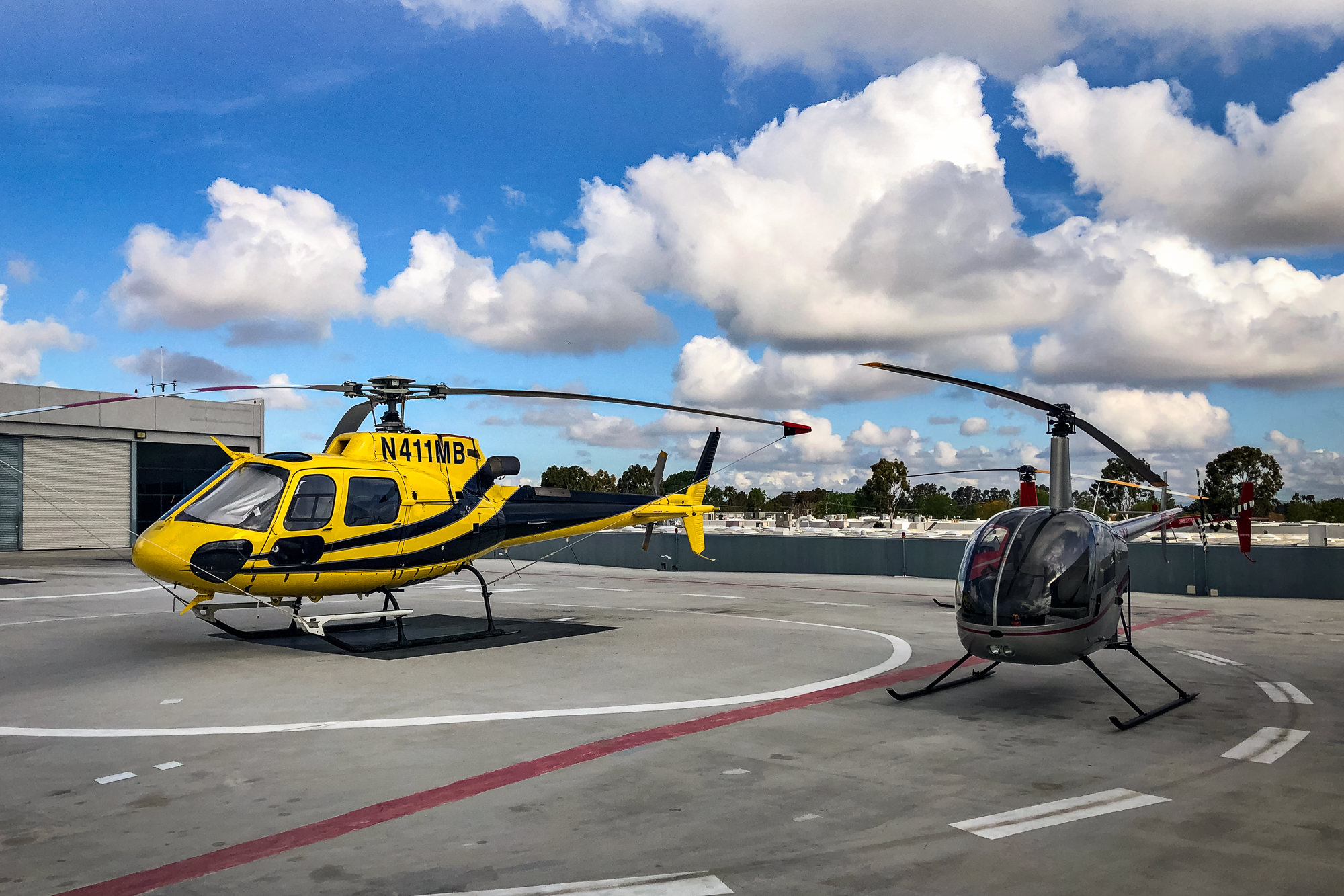
Marc Weisberg offers the most comprehensive aerial photography capability available in the Southern California market. FAA Part 107 certified drone operations for precision site work, close-range architectural detail, and cost-effective coverage of estates and smaller commercial sites. And Robinson R44 helicopter operations for large-scale commercial developments, master-planned communities, infrastructure projects, and luxury estates where altitude, speed, and full-site perspective are required. Most aerial photographers offer one or the other. Marc offers both.
Past aerial commissions include work for CBRE across Los Angeles and San Diego, Cushman and Wakefield, Clune Construction, Irvine Company, Lennar, and luxury residential brokerages including Christie's International Realty and Sotheby's International Realty. Civil engineers, infrastructure developers, and municipal clients requiring site documentation and progress photography from altitude are also among Marc's aerial client base.
"Drone gives you precision. Helicopter gives you altitude, speed, and perspective. Knowing which tool the assignment requires and having access to both is what separates professional aerial photography from everything else on the market."
Orange County · Los Angeles · San Diego
Drone and helicopter aerial photography for luxury real estate and commercial developments.
Your 10-minute call is free. Your image is everything.
Get a Quote — Schedule Your Free 10-Minute Call"Drone aerial photography gives you precision, flexibility, and the ability to position the camera exactly where the image requires. For luxury estates, smaller commercial sites, and close-range architectural detail, drone is the right tool."
Marc's FAA Part 107 certification covers all commercial drone operations in Southern California. Part 107 is the FAA's commercial drone operator certification — it is required for any drone photography used for commercial purposes and authorizes operations in controlled airspace with appropriate waivers and clearances. Not all aerial photographers operating commercially hold this certification. Marc does.
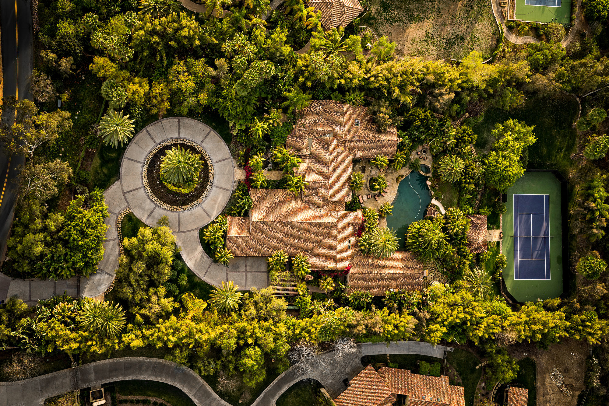
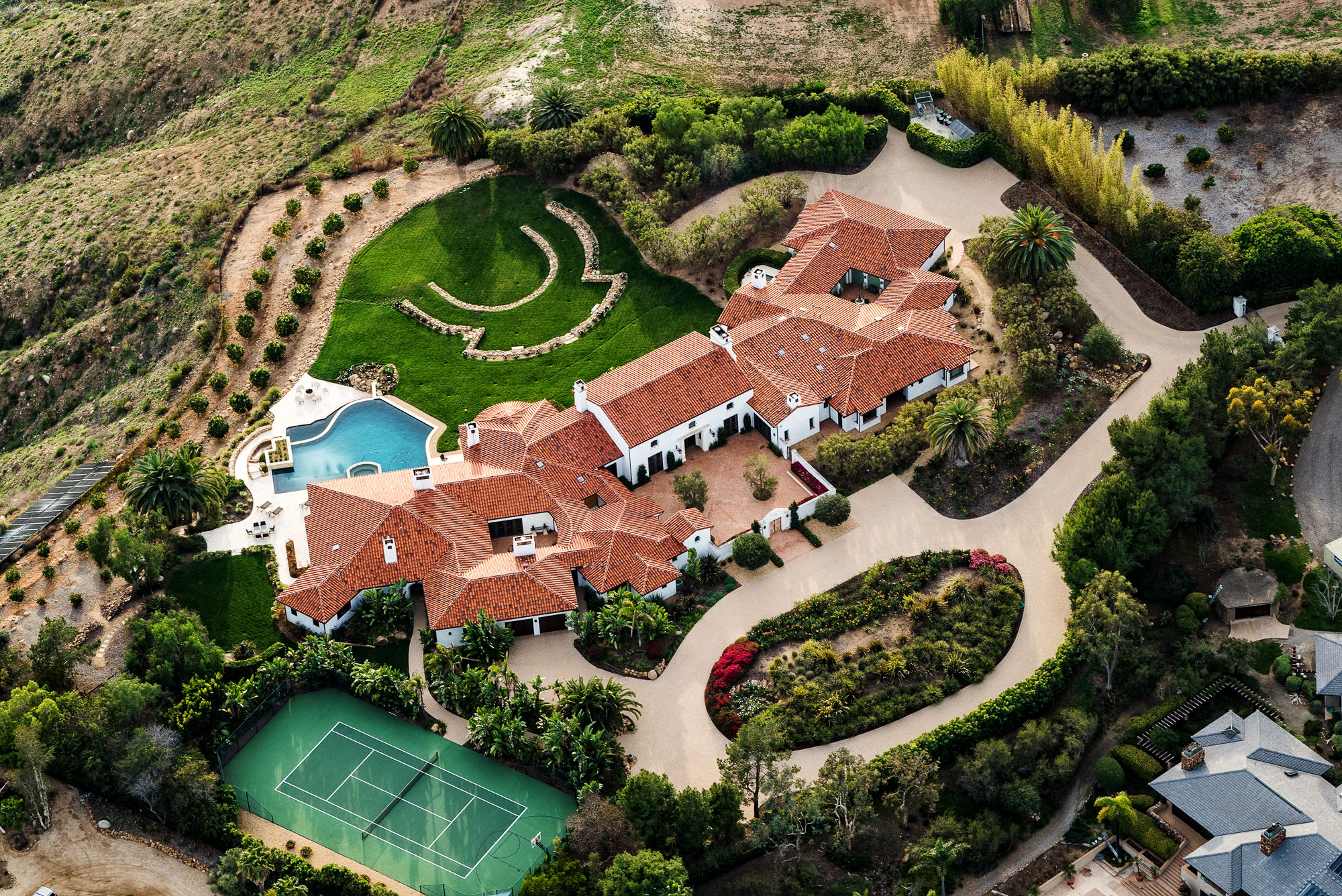
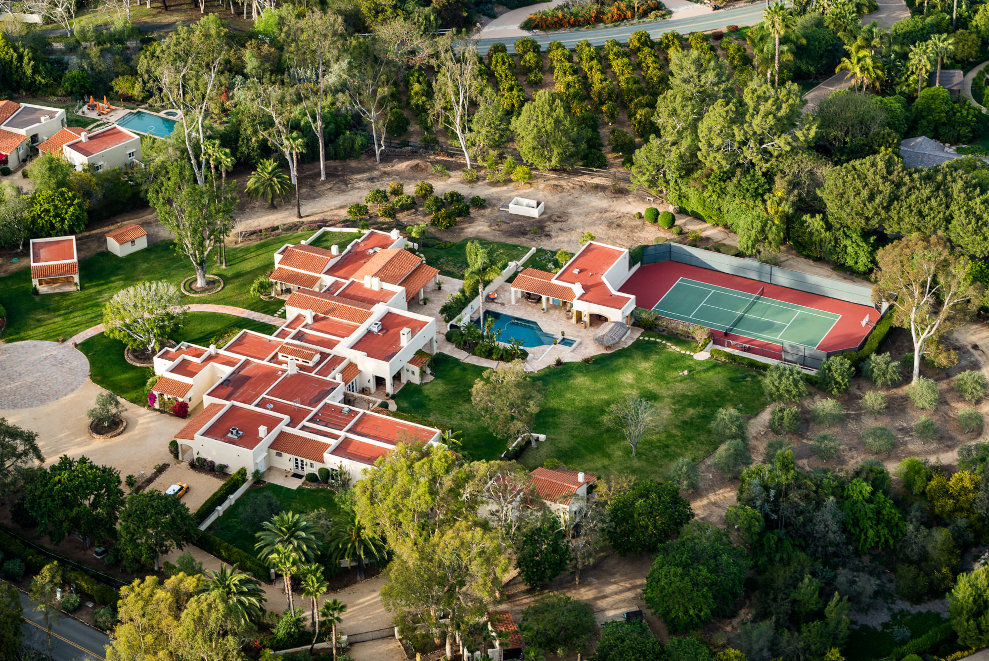
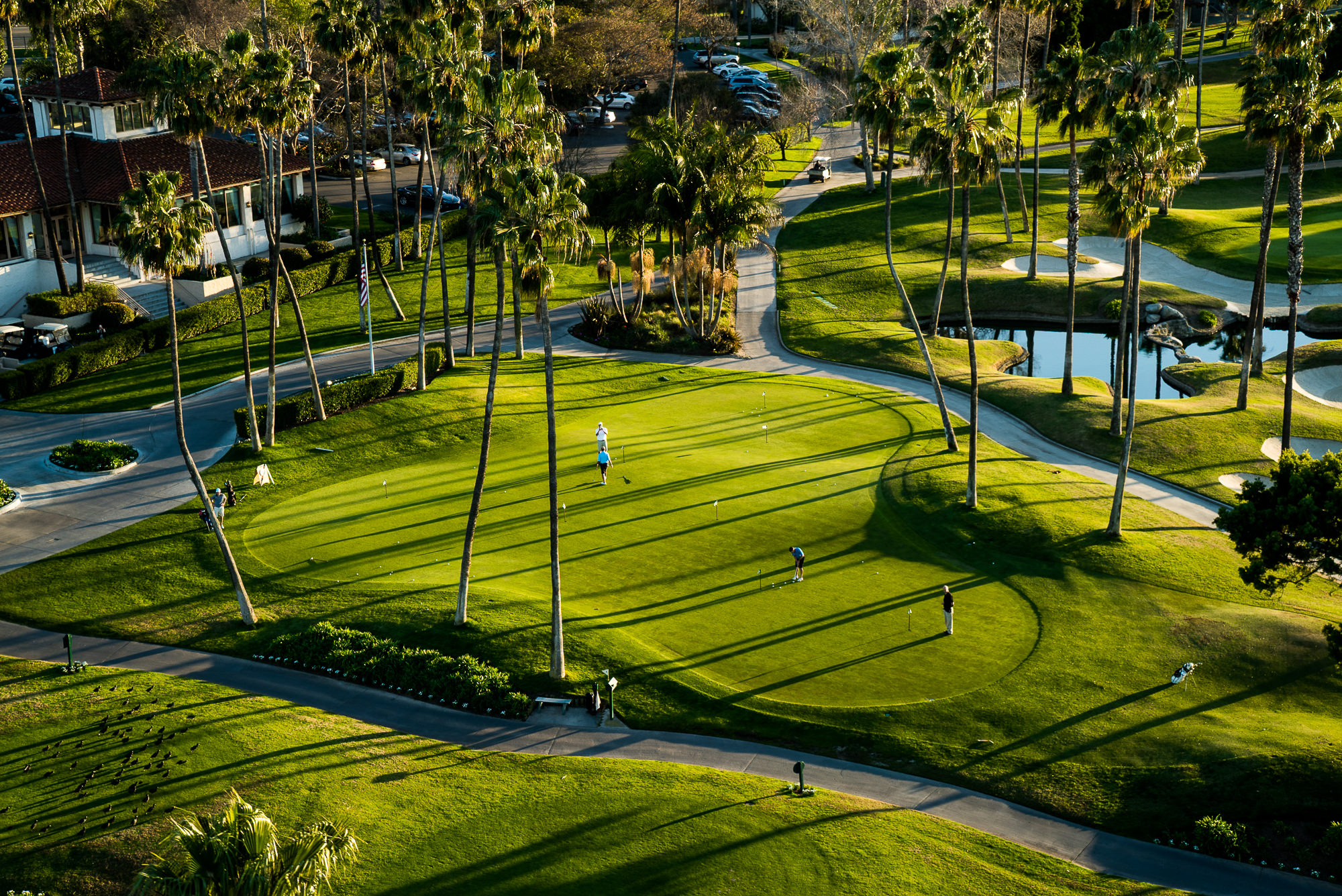
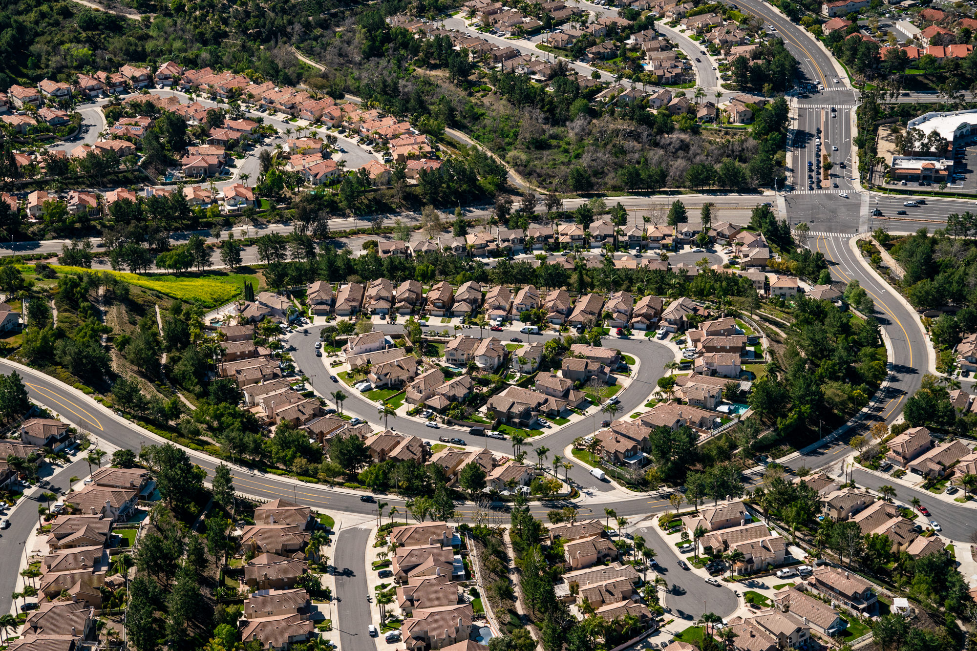
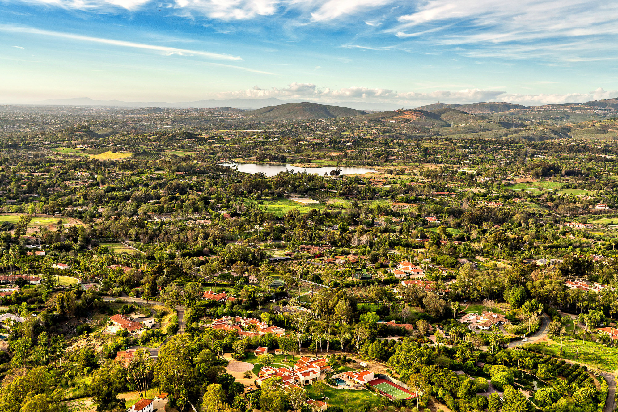
* Luxury Residential Estates: Drone aerial photography communicates site context, ocean frontage, pool and outdoor living areas, and the relationship between a luxury estate and its setting in ways that ground-level photography cannot. For properties in Newport Beach, Laguna Beach, Malibu, and La Jolla where lot position and view orientation are primary value drivers, aerial photography is essential.
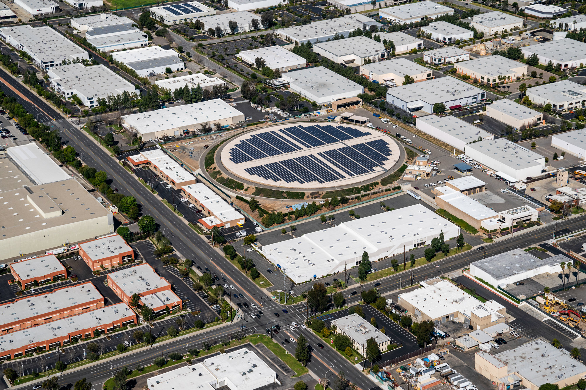
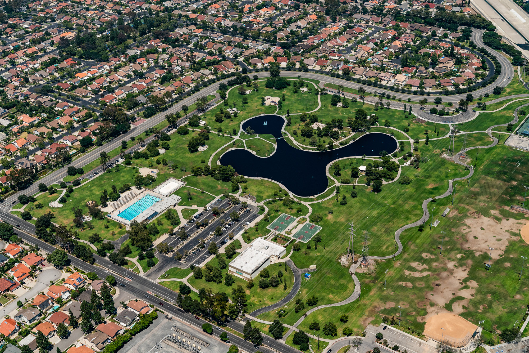
* Commercial Properties and Smaller Developments: Office buildings, retail centers, mid-size industrial facilities, and mixed-use developments benefit from drone aerial photography that communicates site coverage, parking ratios, and proximity to surrounding infrastructure for leasing and investment marketing.
* Construction Progress Documentation: Drone aerial photography provides a systematic and cost-effective method for documenting construction progress at regular intervals throughout a project. Sequential aerial documentation creates a visual record of the construction timeline for developer reports, investor updates, and lender documentation.
* Precision and Detail Work: At lower altitudes, drone photography can capture architectural details, rooftop mechanical systems, facade conditions, and site features that are not visible from ground level and do not require the altitude or speed of helicopter operations.
"Helicopters can legally fly above 400 feet AGL. They cover large sites quickly, reach altitudes that reveal sweeping panoramic views, and produce imagery that drone operations simply cannot match at scale."
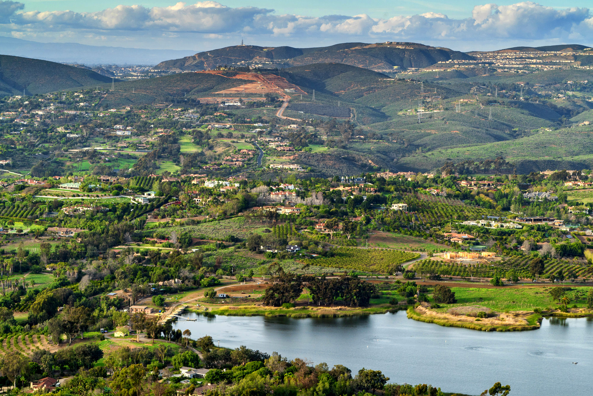
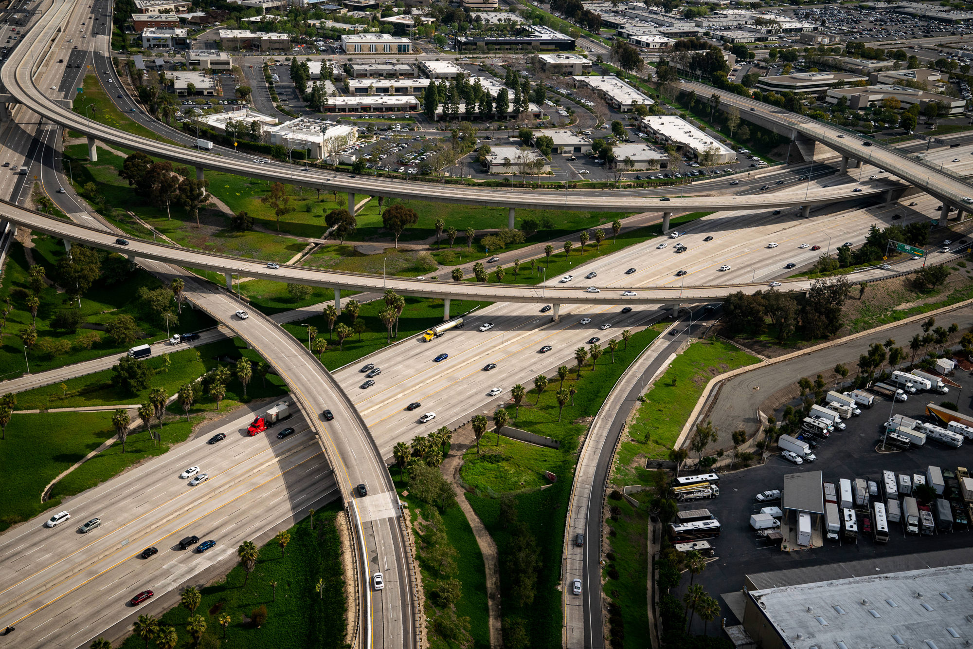
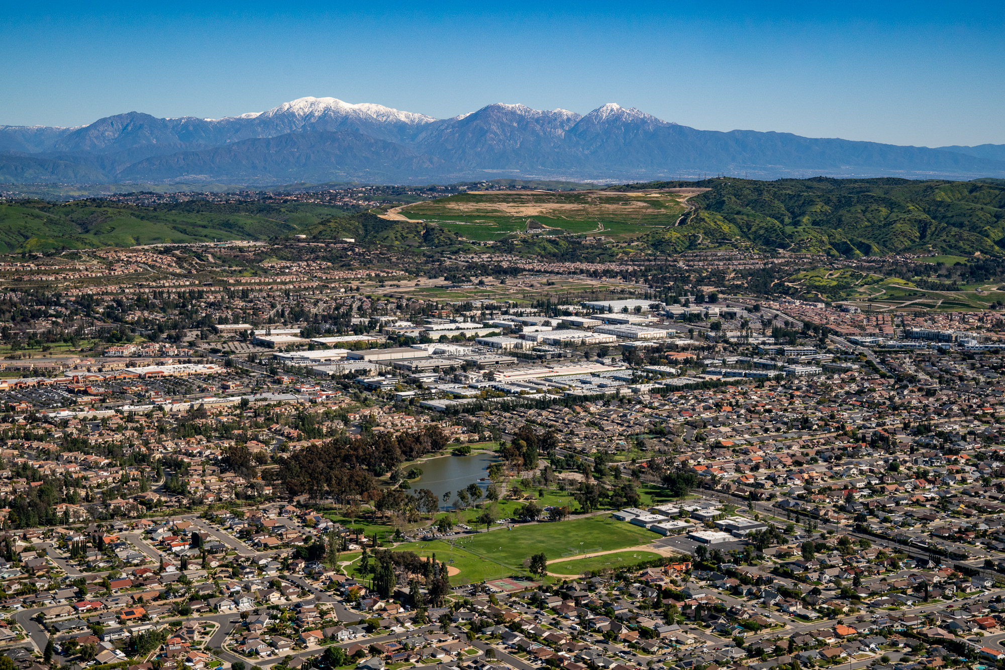
The Robinson R44 helicopter is the professional standard for aerial photography assignments that require altitude, speed, and full-site perspective. FAA regulations limit drone operations to 400 feet above ground level in most circumstances. The R44 has no such ceiling in approved airspace, enabling the sweeping high-altitude perspectives that large-scale commercial developments, master-planned communities, and panoramic luxury estate photography require.
* Large-Scale Commercial Developments: A 1 million square foot industrial logistics facility, a master-planned mixed-use development, or a large retail center requires altitude to communicate its full scale and site context. Helicopter aerial photography covers the full site in a single frame and communicates the asset's scale and market positioning to investors and prospective tenants in a way that drone photography at 400 feet cannot.
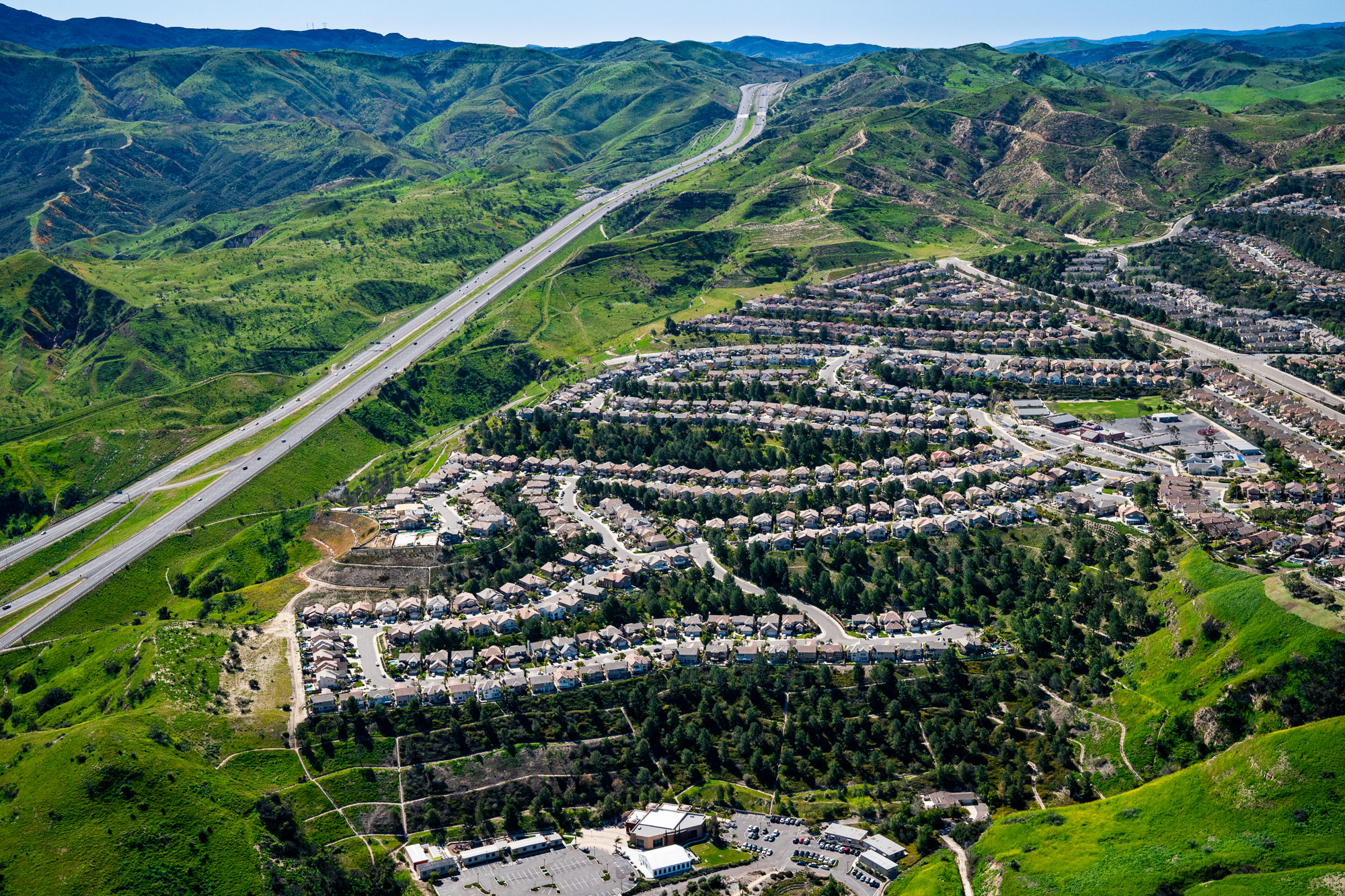
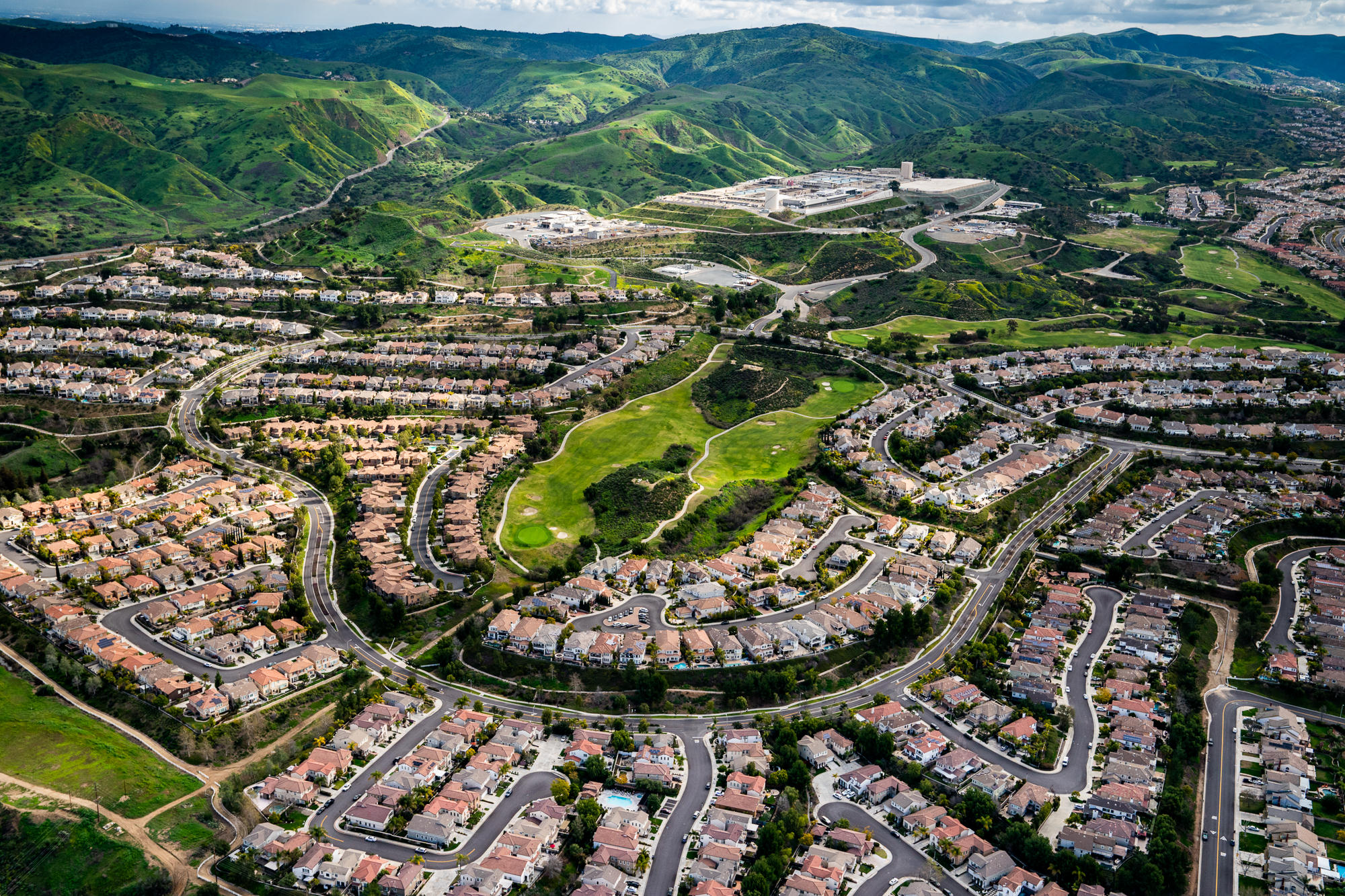
* Master-Planned Communities: Irvine Company master-planned communities and large-scale residential developments require aerial photography that shows the full community layout, amenity positioning, and relationship to surrounding infrastructure. The R44 provides the altitude and coverage area these assignments demand.
* Civil Engineering and Infrastructure: Civil engineers, infrastructure developers, and municipal clients requiring site documentation, topographic context, and progress photography from altitude are among Marc's helicopter aerial clients. The R44 covers large infrastructure projects including highways, bridges, utility corridors, and site remediation projects that require both altitude and geographic coverage.
* Panoramic Luxury Estate Photography: For luxury estates in elevated positions in communities like Pelican Hill, Shady Canyon, Coto de Caza, and the Malibu hills, helicopter aerial photography provides the altitude needed to capture sweeping panoramic views that communicate the full value of the property's setting and orientation.
Orange County · Los Angeles · San Diego
Drone and helicopter aerial photography for luxury real estate and commercial developments.
Your 10-minute call is free. Your image is everything.
Get a Quote — Schedule Your Free 10-Minute Call"The three markets that benefit most from professional aerial photography are luxury real estate, large-scale commercial development, and civil engineering. Marc serves all three with the right tool for each assignment."
Marc's aerial photography practice serves three distinct client markets across Southern California. Each has different technical requirements, different deliverable needs, and different reasons why aerial photography is essential to their work.
* Luxury Real Estate Brokers and Developers: Past aerial commissions include work for Christie's International Realty, Sotheby's International Realty, and Berkshire Hathaway for luxury residential listings in Orange County, Los Angeles, and San Diego where site context, ocean frontage, and property scale require aerial perspective. Luxury residential developers including Lennar have also commissioned aerial photography for finished community marketing.
* Commercial Real Estate Developers and Brokers: Past commercial aerial commissions include work for CBRE, Cushman and Wakefield, Clune Construction, and Irvine Company for large-scale commercial developments, industrial facilities, and master-planned communities across Southern California where altitude and site coverage require helicopter capability beyond drone limitations.
* Civil Engineers and Infrastructure Clients: Site documentation, topographic context photography, construction progress documentation, and finished infrastructure photography for civil engineers, municipal clients, and infrastructure developers requiring altitude, geographic coverage, and systematic documentation from the air.

What Clients Are Saying
From aerial and architectural photography projects
"Marc is a consummate professional photographer. He always meets our deadlines and exceeds expectations. His attention to detail and open communication provides us with confidence that we have elected the right photographer for every assignment."
Tanya von Marschner
Executive Production Associate, HFF Brokerage
"Marc is an exceptional architectural photographer. He has a strong ability to understand a project's intent and translate it into clean, compelling imagery that elevates the asset. His attention to detail, professionalism on site, and consistency across large projects make him a go-to partner for architectural and commercial work. Highly recommended for anyone looking to present their properties at a high level."
Terence Truong
Production Manager, IG1 Communications
"We have worked with Marc on commercial photo shoots, and he always maintains a sense of professionalism within our client spaces. He is very responsive with our various scheduling needs. Marc's images are top-notch. Highly recommended."
Alison Kermode
Clune Construction Company
"These are incredible. Our marketing team actually used the word 'incredible.' We are super excited to get these out there and get some tenants in this space."
Rexford Industrial Properties
Commercial Real Estate
* What is the difference between drone and helicopter aerial photography? Drone operations are limited by FAA regulations to 400 feet above ground level in most circumstances. They excel at precision work, close-range architectural detail, and cost-effective coverage of estates and smaller commercial sites. Helicopter operations have no altitude ceiling in approved airspace, cover large sites quickly, and produce sweeping high-altitude perspectives that drone photography cannot match. Marc offers both capabilities and recommends the right tool based on each assignment's requirements.
* Is Marc FAA certified for commercial drone operations? Yes. Marc holds FAA Part 107 certification, which is required for all commercial drone photography operations. Part 107 certification covers operations in controlled airspace with appropriate waivers and clearances and is the industry standard for professional commercial drone photography.
* What helicopter does Marc use for aerial photography? Marc uses the Robinson R44, the professional standard for aerial photography in Southern California. The R44 provides the stability, visibility, and operational flexibility required for professional real estate and commercial aerial photography assignments.
* What types of properties and projects does Marc photograph from the air? Marc's aerial photography clients include luxury residential estates, commercial developments of all scales, master-planned communities, industrial facilities, hospitality properties, and civil engineering and infrastructure projects. Past aerial commissions include work for CBRE, Cushman and Wakefield, Clune Construction, Irvine Company, Christie's International Realty, and Lennar.
* What markets does Marc serve for aerial photography? Marc's primary aerial photography markets are Orange County, Los Angeles, and San Diego. For significant commissions requiring helicopter operations, travel across Southern California and beyond is available on a project basis.
* How do I book Marc for an aerial photography assignment? The fastest way to get started is a free 10-minute call to discuss your site, scope, timeline, and whether drone or helicopter operations best serve your assignment requirements. Use the scheduling link below.
"Most aerial photographers in Southern California have a drone. Very few have a Robinson R44. The assignments that require altitude, speed, and full-site perspective at scale need the helicopter."
For luxury real estate clients in Orange County and Los Angeles whose properties have site contexts, ocean frontages, or elevated positions that ground-level photography cannot communicate, aerial photography is not optional. It is the image that justifies the asking price and attracts the buyer who understands what they are looking at.
For commercial real estate developers and brokers working with CBRE, Cushman and Wakefield, and Clune Construction on large-scale developments across Los Angeles, Orange County, and San Diego, helicopter aerial photography provides the altitude and site coverage that institutional-grade marketing materials demand. For civil engineers and infrastructure clients requiring systematic aerial documentation from altitude, the R44 provides the operational capability the assignment requires.
The commission process starts with a brief. Understanding the site, the assignment objectives, and whether drone or helicopter operations best serve the deliverable requirements. From there Marc handles all operational logistics including airspace coordination, flight planning, and equipment deployment. The result is professional aerial photography delivered on deadline and ready for immediate deployment across all marketing, leasing, and investor channels.
Orange County · Los Angeles · San Diego
Drone and helicopter aerial photography for luxury real estate and commercial developments.
Your 10-minute call is free. Your image is everything.
Get a Quote — Schedule Your Free 10-Minute CallView the aerial portfolio: Aerial Photography Portfolio · Commercial Real Estate Photography · Luxury Residential Photography
Related services: Commercial Real Estate Photography · Multi-Family Residential Photography · Luxury Residential Photography · Twilight Photography Services
Areas we serve: Irvine · Newport Beach · Los Angeles · Laguna Beach · Newport Coast
Marc Weisberg is an Orange County-based architectural photographer with over 26 years of experience serving luxury residential, commercial, and multi-family clients throughout Southern California. A former Sony Artisan of Imagery, Marc's work has been published in over a dozen books and featured by Adobe, Sony USA, Christie's International Realty, CBRE, Irvine Company, Cushman and Wakefield, Clune Construction, Berkshire Hathaway, and Rexford Industrial. Commissions range from $5 million luxury estates to $1 billion commercial developments across Orange County, Los Angeles, and San Diego.